This is a screamer. It begs you to go faster, which is probably
why I have had my most spectacular crashes here. It is lined with Manzanita
and if you aren't familiar with that stuff it's like landing in a pile of
spears. Manzanita means "little apple" in Spanish but in this case
if you stray you are the apple and it is the arrow.
There are 3 sections, the lowest being easiest and top being the hardest.
All in all none of it is that hard but your experience may differ. If you
see something you don't like walk down it. There are no cliffs to fall off
of. The trail is easy to follow as it is well used but there are several trails
going off other places or looping out and back, just stay on the one most
used and you'll be fine. Lots of water bars to fly, jump or crash off of.
To get to the ride you go north on Hwy 41 to Oakhurst. After passing through
Oakhurst look for the Bass Lake turnoff (Road 222), you can only make a right.
It is 10.1 miles to Central Camp road from here. After going up and over a
small pass the road forks. Go left on Road 274 and take it to the end of Bass
Lake. You will pass by the Marina View development and then right after it
you will see Central Camp Road on the left. Immediately after it turn right
and park (N37 17.2407 W119 31.1656).
You can either ride up the trail or Central Camp Road. I always ride up
the road for the exercise. It's constantly uphill but it's never steep. You
only climb about 1700 feet over 9 miles. The elevation at the parking area
is 3500' and tops out at 5200'. So get out of your car and get on your bike.
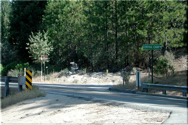
Head up Central Camp Road, which is right across the street. Be careful crossing
the street as it is a blind turn and they are traveling fast. If you want
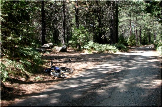
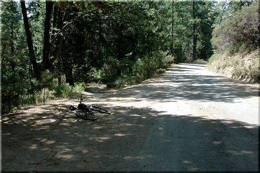
to ride up the trail it's fifty yards up the road on your left.
The road switchbacks up the hill while the single track comes right down
the ridge line or at least takes a much more direct route. It's 9 miles up
the road and 5 down the single track. It's a paved/dirt road with a gate a
hundred yards up from Road 274. The gate is closed in the winter when the
snows come. At mile .9 there is a fork on the right that provides access to
Browns Creek Ditch. A great side hike in the spring with a very tall waterfall
that drops into a nice pool in Willow Creek.
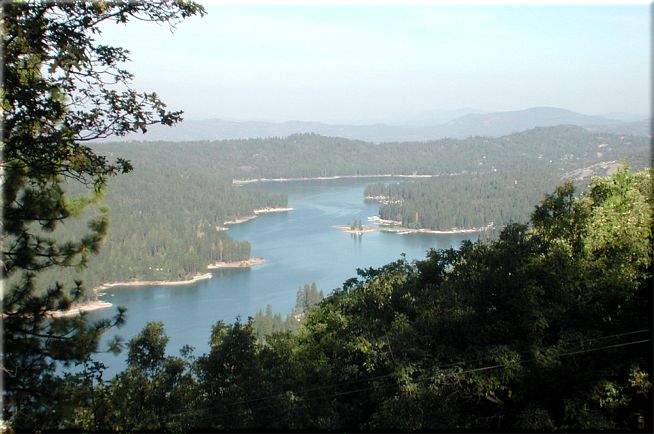
Off to the left at mile 4.7 (N37 18.0618 W119 30.9458) there is a great
view of Bass Lake, at least on a clear day. This day was terrible for any
views towards the San Joaquin Valley. You are almost halfway up at this point
and have just passed the single track at the last sweeping right turn.
Mile 7-7.7 will provide a views of Browns
Creek Ditch, Willow Creek Drainage and to the south you can see the old North Fork Sawmill (large clearing) in
the distance. On a clear day, which this was not, the sawmill is just above
the rock face in the distance.
At mile 8.0 (N37 19.2450 W119 29.6982) you will be making a left onto 6S06.
There is a sign there but it doesn't indicate where you are headed. It indicates
the Whiskers and Central camp are just up the road (if you weren't making
a left) and North Fork is 12 miles behind you. North Fork is about four miles
further down Road 274 from where you parked.
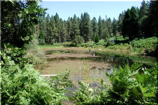
I rode this today (mid August) and was surprised to see that this
pond had water in it. I guess I don't normally ride this trail this time of year.
The pond is at mile 8.7 (N37 19.2035 W119 30.1096) and at this point you will
have ferns on both sides of the road.
It was a couple hundred yards past this pond I saw the largest bear I have
ever seen in our local mountains. It came out of the ferns on the right (maybe
25 yards in front of me) and was looking up the road and didn't see me. I
was riding and getting too close so I whistled and it ran off through the
woods to the left. It struck me that this large animal made little to no noise
running through the dense forest, very impressive. Well the bear ran off to
the left, which at the time it didn't occur to me that's the direction I'm
headed. So I get to the top and turn to come down and in one of the fast technical
parts I have a slight miscalculation and fly over the handlebars ending up
on my back. While I was laying there it dawned on me, "I wonder where
that bear is?"
So at mile 9.1 (N37 19.5166 W119 30.2975) you will be making a left onto
the single track that will take you back down to the car. You still have some
mild climbing to do so don't let any air out of your tires or lower you seat
just yet.
Mile 9.2 (N37 19.4455 W119 30.3368) provides an excellent view of Shuteye
Peak back to the north and nice big flat rock to take a fuel break on. A tenth
of a mile more and you have topped out as far as elevation is concerned for
this ride (5200').
When you get to mile 9.7 (N37 19.1397 W119 30.3107) just after a tuff little
rocky uphill that I always walk you can now lower the seat and let some air
out of those tires and let the screaming begin. For the first 2/10's of a
mile you will still have some short ups to do but if you are flying they will
be no big deal. Even if you aren't there really isn't anything that requires
much effort. This top section has a few steep technical spots so pay attention.
There are also a couple of loose rocky stretches.
When you get to the road (the one you came up on) head down it for a couple
hundred yards. You will then veer to your left back onto the single
track at mile 10.7 (N37 18.5948 W119 30.3851).
This section will be a bit faster and a bit less technical. Yee Haw!!!
For the next mile to boot. You finish it at the road you came up again.
This is the crossing that is just below the turnout for the Bass Lake view.
You are at mile 11.8 (N37 17.9810 W119 30.8666) and the other side of the
single track is directly in front of you. This section will be a bit less
technical and a bit faster for a little over 2 miles.
When you are at just about mile 14 you will come to the bottom of Central
Camp Road, the car will be just to your right and you'll be thinking, "Why
didn't we bring a shuttle car."