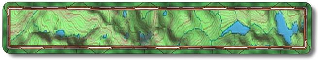
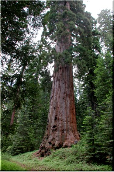
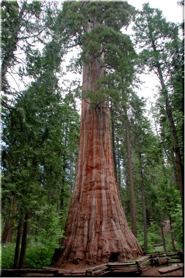
Big Trees

The Big Trees trail is very close to the Lewis Creek Trail and in fact overlaps for a number of miles. It is a bit easier and shorter than the Lewis Creek trail. It will be at its best in the spring and fall. The trail is an out and back (approx. 17 miles) with a couple of side loops.

To get to the Lewis Creek trail drive north on Hwy 41 towards Oakhurst/Yosemite. After passing through Oakhurst you will drive by Road 222 (only goes right to Bass Lake), continue on Hwy 41 north for 10 miles then make a right on Jackson/Big Sandy Road. If you come to the Marriot or Fish Camp you have gone to far. You will pass by some homes and the back entrance to the Marriot (on your left) then the road turns to dirt. Go a 1/4 mile to (N37°24.9922' W119°37.5804') park on either the right or the left. If you park on the left the single track starts at the right rear of the parking area looking north.

Ride down the single track for a little bit until you get to the creek. Once at the creek (mile .2 - N37 28.5623 W119 37.8340) you will take a right so you can climb back out and up to the road. This is a beautiful single track and a good way to start the trail. At the road (mile .6 - N37 28.3843 W119 37.6834) make a left. You will be gently climbing for the next couple miles.

After passing some corrals on your right you will come to Road 5S18 (mile 2.5 - N37 28.1652 W119 36.9643) which goes to the right. There is a sign indicating that Sugar Pine and Nelder Grove is up this road. Nelder Grove is our destination but we will take a bit more direct route so the mileage is not accurate. This road/double track is a bit steeper at first but will soon mellow out for the next few miles. On a clear day you will get some views of the San Joaquin Valley and maybe even the coast range.

At (mile 3.8 - N37 27.2504 W119 36.6241) make a left leaving the double track. Fifty feet up the hill is a single track going to the right. The next .6 of a mile is the hardest climbing this trail has to offer. Once on top you will cruise for a while. At mile 4.8 you will pass through an open gate, unless its early spring and then you will have snow problems and probably won't go much further.

The first giant Sequoia that you will come to is the Hawksworth Tree (mile 5.4 - N37 26.4068 W119 36.2427). Make a left (u-turn) just before it and head up to Old Grandad and his kids. This is an alternate loop that drops you back onto the trail you just left. This side trip is worth it and you can ride back the other way.

After riding/walking/sliding down a rather steep loose rocky trail you will rejoin the trail you left at the Hawksworth tree. Make a left or straight depending how you negotiated the downhill (mile 5.8 - N37 26.1912 W119 36.0322).

Enjoy some downhill for the next mile and a half with views to the right. Towards the end just when you think you can let the bike go watch out for a couple of water bars. This downhill section ends in an open area (mile 7.3 - N37 25.8175 W119 35.0125). Look to the left for a sign indicating the entrance to the Chimney Tree Trail. This trail takes you for a loop that will end up bringing you back to this spot via the dirt road on your right.

At (mile 8.5 - N37 25.8899 W119 34.7728) the Bull Buck Trail make a left to visit the Bull Buck Tree. This is a short out and back and a common lunch spot for bikers. The Bull Buck Tree - Estimated age is 2700 years. Height is 247.31' - Circumference at 4 1/2' is 84.2' - as of 9/4/1975. When leaving the tree go back down the trail but don't make a right on the Chimney Tree Trail, go straight on to the campgrounds.

Heading down to the campgrounds you will come to the dirt road (mile 8.8 - N37 25.7753 W119 34.9939) that will take you back. Make a right on the road but don't go right again on Road 5S19A, it's leads to a camp area. Go one tenth of a mile down the road to the open area. It has a Nelder Grove Campground sign (mile 8.9 - N37 25.8284 W119 35.0502) and the entrance to the single track is to the right of the sign diagonally across the open area. This is the fast single track that ended with those nasty water bars. You will find that it is not nearly as fast going this way. :-)

After riding up the single track for 1.5 miles you will come to where the Old Grandad Trail dropped in on the right (mile 10.5 - N37 26.1870 W119 36.0461). Stay on the trail going left and up for a little bit. For the most part this is all the climbing you have left as the rest of the trip is either gently up, flat or downhill. Half way around this loop there is a great view of the Marriot in the distance (mile 11.2 - N37 26.4055 W119 36.4613). Next you will pass by the Hawksworth Tree again leaving the Old Grandad Trail to your right.

Make a left at mile 14.4 (N37 28.1652 W119 36.9643) onto the road that goes to Fish Camp. Two miles down the road (mile 16.3 - N37 28.3956 W119 37.6863) you can make a right onto the single track that goes to the creek or continue down the road for .3 of a mile to your vehicle.

Site created by D. J. Gabbard
Copyright © 2000-2004
All rights reserved.