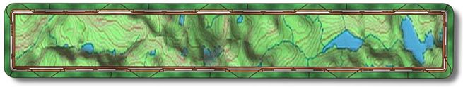
The Goat Mountain Trail is just across Bass Lake from the
0007 Trail. This trail has fantastic views at the top and is a real kick to
come down. There are only a couple of rocky technical sections but other then
that you will be riding a firm narrow single track for 1/2 the trip. The rest
is dirt road and paved road if you don't run a shuttle. It's just under 11
miles if you ride the whole loop (see Trail
Map ) with 1670' of climb. This
trail is for the intermediate or maybe an adventurous beginning rider. Not
a first time ride by any means.
There are two drawbacks to this trail. If you are sensitive to poison oak
then you need to plan for it because there is plenty of that. I have to scratch
myself with it so it isn't or hasn't been a problem for me on this trail...yet.
A friend who is very sensitive to it wears long pants and shirts (usually
polypro or some other light material) for protection. There are also lotions
(Stokogard Outdoor Cream) you can use to help protect you from this nasty
plant. In the fall the poison oak has dropped it's leaves and can be hard
to recognize. It is still potent during this time though I don't think it
is as potent as it is in the spring. That's just my opinion and others may
differ. The other drawback is the gnats/flies. Spring should be better but
fall is terrible. I did the trail last weekend, early October, and they drove
me nuts. If you can move along faster than 6-mph they won't be that bad but
that is hard to do on the way up. Maybe bring a herd of farm animals with
you. I'll be wearing a mosquito net the next time. On the way down you won't
notice them.
To get there drive up Hwy 41 to Oakhurst. When you come down the hill into
Oakhurst the first traffic light will be Hwy 49. The next light (.2 mile past
49) is Road 426 and you'll make a right there. In 6.4 miles Road 426 turns
left and goes to Bass Lake and The Forks. Make that left and go another .9
miles to Road 222 and make a right. After you make the right there will be
two turnouts (N37 18.8501 W119 34.0431) on the left in .3 miles. If you choose
to start your ride from here make sure that you turn your car around so your
vehicle will be facing the correct direction while parked in the turnouts.
This makes the local authorities happy.
You can start this ride from anywhere between the Forks Campground and
Spring Cove Campground. If it's summer and you plan to stay in the area overnight
these are just two of the many options available. I believe all of the campgrounds
are closed in the winter.
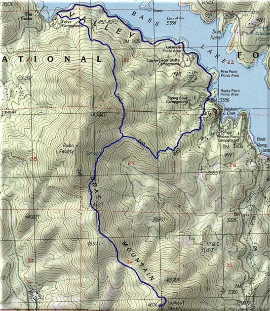
So now you have parked in the first turnout on the left past the Forks
Campground, which means you will be riding east along the lake on Road 222
for 2.3 miles. It makes for a good warm up. At 2.3 miles (N37 18.0827 W119
32.4743) you come to Spring Cove Campground and just past the campground entrance
(20 yards) is the start of the Spring Cove Trail. Make a right and head up
the trail.
At mile 2.5 the single track will dump you onto a jeep trail, make a right.
At 2.7 (N37 17.8030 W119 32.6385) go right again on the single track and then
at mile 2.8 (N37 17.7853 W119 32.7592) make another right onto the same jeep
trail. Travel up the road for .2 of a mile (mile 3.0 - N37 17.6611 W119 32.8503)
then take a right onto the single track.
The next turn is at mile 3.9 (N37 17.7837 W119 33.3768) where you will
go left at the junction of the Spring Cove and Goat Mountain Trails. If you
wanted to go back to the car early you can make a right here to go to the
Forks Campground. Otherwise make a left and climb to the top of the single
track which ends at the dirt road that will take you to the Goat Mountain
lookout. The dirt road is at mile 4.7 (N37 17.2761 W119 33.7598) and you will
make a left there. Don't miss the turn onto this single track on the way back
down. Just up the road will be a gate and right after the gate is a single
track on the left. Take the single track as it is a shortcut that rejoins
the road shortly. This road ends at the lookout tower, elevation 4670', at
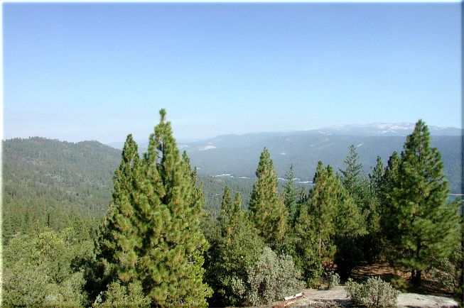
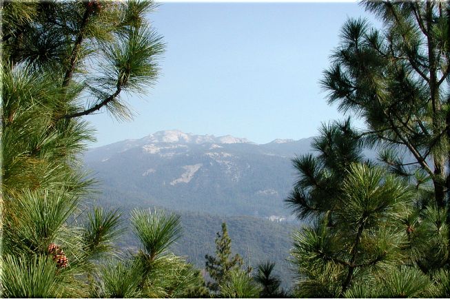
mile 6.3 (N37 16.3212 W119 33.0109). Great views from up there on clear days
of Bass Lake, Shuteye, North Fork, Oakhurst and the valley. It was very hazy
when I was up there but I did get a decent picture of Bass
Lake and Shuteye
Peak.
On the way down don't forget the single track shortcut on your right (mile
7.8 - N37 17.1461 W119 33.7312). After passing around the gate the Goat Mountain
Trail (single track) will be on your right (mile 7.9 - N37 17.2938 W119 33.7521).
Next will be the junction of the Goat Mountain and Spring Cove Trails (mile
8.7 - N37 17.7718 W119 33.4035) where you will go left. The trail is fast
and fun from here on out.
At mile 10.5 (N37 18.7545 W119 33.8863) you come to a dirt road where you'll
make a right and then an immediate left back onto the single track. The next
junction will be the Forks Campground (mile 10.7 - N37 18.7960 W119 34.0804),
make a right heading down through the campground to Road 222 where you make
another right. The car is just up the road on the left.