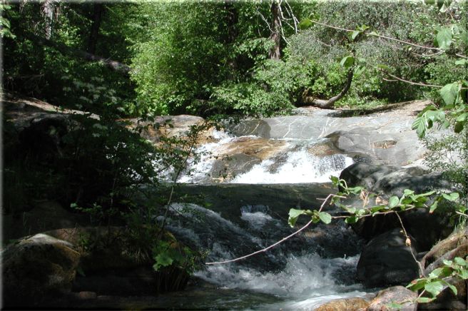
Lewis Creek

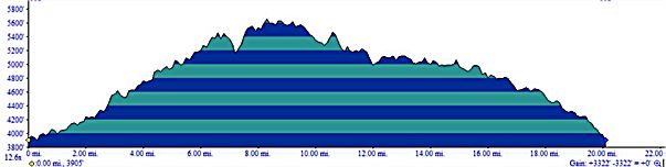
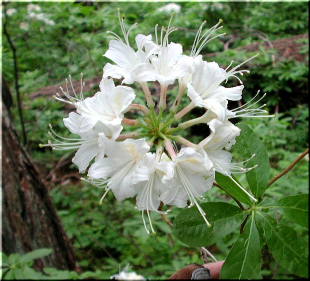
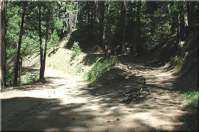
This is a scenic trail that requires some time and effort but is worth every minute of it. It is some kind of beautiful in the spring and Lewis Creek will be flowing. This trail might get a bit warm in the middle of summer though it does offer plenty of shade. It is around 20 miles of riding.

To get to the Lewis Creek trail drive north on Hwy 41 towards Oakhurst/Yosemite. After passing through Oakhurst you will drive by Road 222 (only goes right to Bass Lake), continue on Hwy 41 north for 4 miles (N37°24.9922' W119°37.5804'). At 4 miles (from Rd 222) you'll notice a turnout on the right (paved parking area) which provides access to Lewis Creek and Corlieu Falls. I believe is or was an historical area for Mr. Corlieu's mining claim. Don't quote me on that though.

Enter trail on north end of parking lot heading down to the creek. After riding down for a short bit the steady climb begin. You will be climbing for the next 8-9 miles (see Trail Profile). Not a nasty climb though there are a few spots that are steep but for the most part it is just a steady climb. The first 2 miles is single track along the creek. If it's spring and you want to get a picture of the Azaleas do so now as they will be few and far between the rest of the way. Unless, of course, you extend your ride to include the Big Trees.

At the 2 mile mark you enter Sugar Pine and make a right on the paved road (N37°26.3315' W119°38.0133'). Ride up the road for .3 of a mile until you come to a fork (N37°26.4564' W119°37.9180'). You will be going right towards Nelder Grove. This is a dirt road/double track for the next 7-8 miles.

At mile 5.5 you will come to a road (5S18) that goes back to the left and has a gate just 20 yards up the road (should be open) (N37°25.5494' W119°36.8317'). Make the left (u-turn) up the road and continue to climb. Take heart that you are more than halfway up the climb now.

After enjoying a little downhill you will come to another turn. This will be a left on 6S07 at mile 9.7 and there should be a sign indicating that Fish Camp is 3 miles away (N37°28.1735' W119°36.9357'). For the most part it will be downhill to Fish Camp with a couple of small climbs when leaving the road to enjoy some single track.

The single track is at 11.7 miles and on your right (N37°28.4162' W119°37.6937'). This trail will go for about .75 of a mile and then reenter the same road. Go right down the road (still 6S07) for .25 and watch for a short (50 feet) single track that climbs up the hill to the Marriot on your right. You will be able to see the Marriot from the dirt road. Take it to the parking lot (12.6 miles - N37°28.3393' W119°38.0925') then go right and then left leaving the Marriot to your right as you ride NW to Hwy 41.

You will take a short ride north on Hwy 41 (100 yards) and then make left on 5S09 (13 miles - N37°28.4986' W119°38.3448'). About an 1/8 of a mile up 5S09 make a left on the paved road and head straight onto the dirt road.

After riding this road/double track for 3.3 (16.3 total) miles you come to a road crossing (N37°26.5523' W119°39.3120'). Just head straight across the road onto the single track. Right after you drop into the single track you will come to a Y, take the left fork called Powerline. This is the trail you will follow back to the Corlieu parking area (where you started from). Although you can take the right fork called Stagecoach we didn't so I can't tell you how to navigate it. I do know that you will come across it at some point later.

At mile 16.6 you will come to a four way crossing (N37°26.4548' W119°39.0046'). Go straight across the road that travels right to left and look for the single track just to the left of the dirt road that is running straight ahead. The single track will run parallel to that dirt road.

Go almost a mile and look for the Powerline single track that goes left, which is at 17.4 miles (N37°25.9498' W119°38.7288'). After you make the left you will come to another Y, go right.

At 18.2 miles you come to a junction of trails. If you look straight across the intersection you will see a clean single track with a large water bar that heads gently up hill. You can take this but I would recommend taking the one just to the left of it. Either one will drop you onto a dirt/gravel/paved road. Go left and head to Hwy 41, it's not far. Make a right on Hwy 41, the Corlieu parking area is just down the road on your left.

All mileage is approximate.

Site created by D. J. Gabbard
Copyright © 2000-2004
All rights reserved.