The first trail to be recorded is in the foothills just out
of Fresno, CA. This ride starts the Sky Harbor (N37 02.2605 W119 38.9487)
area of Millerton Lake and finishes at Squaws Leap (N37 04.3734 W119 33.5364),
near Auberry. It can be ridden either way and I can't say that either is easier
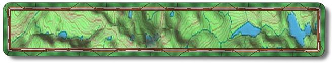
because both end with quite the little hill. Open the "Trail Profile" and
you will see why we decided to start at Sky Harbor even though we road it
upriver. Over all it is approximately 14.5 miles. This trail is at low altitude
and would be a very hot ride in the summer so if you are thinking you want
to do it then start at daybreak and bring lots of water. It took us six hours
but we stopped a lot to take pictures as it was spring time and it was covered
with wildflowers.
To get to Sky Harbor from Fresno drive out Friant Road past the entrance
to the lake and just before Table Mountain Casino turn left onto Sky Harbor
Road. Go all the way to the end of the road and park. Ride thru the lakes
day use parking area (it's been closed lately) and at the restrooms you will
notice a trail going straight up the hill. It starts not more then 10 feet
from the curb of the parking area. In a 100 yards or so you pass thru a metal
gate and then up and up. If you ride from just outside the parking area (end
of Sky Harbor Road) it will be 1.04 miles to the top of the hill (N37 02.1008
W119 38.3242).
The top of the hill is a four way trail and you will take the only one
that leads downhill that you didn't just come up. You will now enjoy a long
downhill (for the most part) into the river/lake gorge. Down a ways you will
see a small trail leading off to the right and up, keep going down thinking
how much fun it would or will be to ride back up this. It's really not that
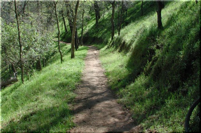
bad as I've done just that many times as I normally ride in about 5-7 miles
and then back out. Here is a picture of the trail
ahead that takes you back
down near lake level. This is just downhill from the small trail leading off
to the right and up.
3.07 miles (N37 01.0683 W119 38.0841) in you should come to another metal
gate. At this point trail will go up and down for quite awhile, nothing drastic
at all. At 5.70 miles (N37 02.2322 W119 36.5955) you will come to the first
barbwire gate (make sure to close all gates behind you). A short ride later,
5.78 miles, you will come to another barbwire gate (N37 02.3055 W119 36.5337).
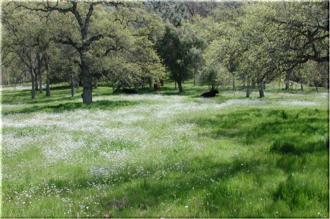
Right after this you will ride through a small creek if it's spring time.
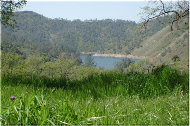
If it's spring you will pass through this meadow, this shot is taken looking
back up the lake. The other side of the meadow had three
bulls lounging about.
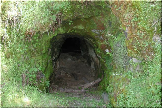
Note that trail markers up until now and for some distance more are green
poles with white arrows. 7.64 miles in there will be a abandoned mining cave
on your left (N37 03.4147 W119 36.2791). (Picture
of the mine here) After
this there will be two climbs over the next couple of miles. You will have
been and will continue to ride under the Table Top Mountains on your right.
At 9.88 miles you come to yet another barbwire gate (N37 03.8762 W119 35.4912).
You will be headed down to Temperance Flat, which is about 1.5 miles away.
When you drop into the Temperance Flat recreation area you will (hopefully)
notice the new trail sign just before you start riding on the dirt road. The
new signs will be 4x4 wooden posts with RT (River Trail) on them. At approximately
11.5 miles, after riding up the road and passing a private home on your left
you will see another RT trail marker on your left. You will leave the road
at this point and be back on single track/overgrown jeep road. Follow the
signs! They are few and far between but trust your instinct or a map like
we should have.
If you followed the right road/trail (it really isn't that hard to do)
at mile 12 or just before the trail will split with the larger one going slightly
up (on the right) and another going slightly down (on the left). Take the
one to the left although either one will end up nearly in the same place.
Large creek drainage here and the trail is washed out so pick up the bike
and scramble across the boulder/poison oak area to the other side of the creek.
You will be able to see the trail on the other side. Shortly after, you will
come to another creek that flows beneath you and the ground. In the spring
you can here it, sounds very large, but not see it unless you climb up the
rocks on the right. Worth the climb as there are several caves up there.
At 12.4 miles and just after the subterranean creek (N37 03.8006 W119 33.8673)
you will come to another metal gate. You have just started the climb out and
I do mean climb. At 12.5 miles is the last metal gate, you can go thru it
and turn to your immediate left then follow that trail down for a bit and
then back up to the powerhouse road. Do this if you parked at the end of Smalley
Road in the dirt parking area adjacent to the powerhouse. If you camped or
parked at the Squaws Leap camp area then continue up hill and finish your
ride by following the trail above and behind the large green storage tank.
Either way is a climb but the powerhouse will be slightly easier.
To get to Squaws Leap stay on Friant Road (at this point it is actually
called Millerton Road) past Sky Harbor Road (and casino) and make a left onto
Auberry Road at the T intersection. Follow this up to the town of Prather
and you will come to another T, turn left. This is Hwy 168, head up it for
a couple of miles then make a left back onto Auberry Road. As soon as you
pass through the town of Auberry the road forks, take the left fork onto Powerhouse
Road. After a few miles you will come to Smalley Road on your left and take
it either to the end or a quarter mile from the end is a parking/camping area
on your right. This parking lot leads to other trails in the area and there
is a large map there.