I've done this ride 6 or 8 times and have either seen or heard
people talk about seeing rattle snakes. I have never heard of anyone getting
bit. While coming downhill on one ride it sounded like I knocked off a high
pressure sprinkler head. I stopped and walked back up the trail to find a
rattler the size of my arm right next to the trail. I scared it when I rode
by and it was a bit upset. I'd passed several riders a mile back taking a
break so I found a stick to move the snake away from the trail and then went
on my way. I wouldn't let the snake sightings keep you from riding this trail
but be aware of their presence.
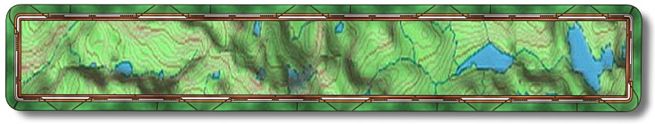
The Squaws Leap ride is North West of the town of Auberry and is on BLM
land. It is well marked and in good condition. It is moderately hard to hard
with numerous technical sections. Over the 7.7 miles the total altitude gain
is 1520 plus feet. To get to this ride you can go up Friant Road to Prather
and then go left on Hwy168 or just go up Hwy 168 till you get to Auberry Road
(approx. 25 miles from Fresno). Go left to Auberry and after you pass through
town make a left on Power House Road. There is a school on the left just before
the turn. Go 1.9 miles then make a left on Smalley Road. There is a sign there
for Squaws Leap. 4.5 miles down the road there will be a parking area on the
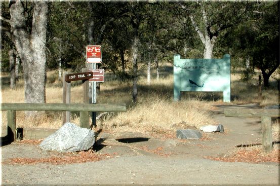
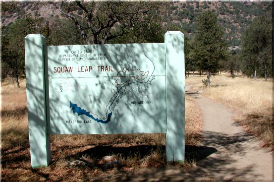
right (N37 04.9790 W119 33.2497). The trail starts on the left of the parking
area. 20 yards down the trail there is a sign with both the Temperance and
Squaws Leap Loop Trails.
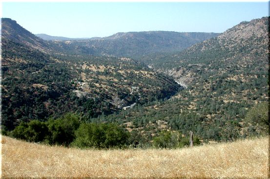
In a little over a mile down the trail you will have gone through two gates
and come to the bridge over the San Joaquin River. This once great river was
the largest salmon producing river on the west coast of North America before
it became the most dammed river in the US. I believe there is something like
17 dams along its length. The only section that is natural today starts north
of the Minarets and ends in Mammoth Pool out of North Fork. This really bugs
me.
After crossing the bridge you will climb up a few hundred yards to where
the trail splits. The split is 1.1 miles (N37 05.5847 W119 33.2362) from the
start. You can go left and take a longer trip to the top with less pitch.
You would then come down a difficult, steep section back to where you are
now. Or you can go straight (right) and ride up the steep difficult part to
enjoy a nice long downhill. I have always chosen to go straight as most people
I've come across.
1 mile after going straight at the intersection (good choice I might add)
you can look back down at the penstock
and bridge. After riding another 1.3
miles there will be another view of the river
valley looking south.
At mile 3.8 (N37 06.3050 W119 33.1811) you will make a left onto an old
dirt road that has almost returned to single track. For the next .3 miles
it will be mostly rolling with some mild climbing compared to what you had
been riding up. A hundred yards or so past mile 4.1 (N37 06.3179 W119 33.4631)
you will start the downhill.
The trail will have a minor fork going to the right just before mile 4.4
(N37 06.2667 W119 33.6845), ignore it and go left and then left again at the
next fork. There is a sign there that makes it obvious that you go left. It
is also obvious by now that you are riding the trail backwards. Sometimes
it's better to go against the flow. I have never run into riders coming up
this way, maybe BLM is confused.
Make a left onto the old dirt road at mile 5.1 (N37 06.0282 W119 33.8133)
and head downhill. At mile 5.3 (N37 05.8351 W119 33.7837) you will come to
a dip in the road. There will be a sign with a single track exiting on the
left. The sign indicates that to stay on the trail you would continue straight
down the road. Or you can take this single track and end up back on the road
a little further down.
The road turns back into single track at mile 6.4 and shortly after you
will make a right at the trail intersection to go back to the bridge. You
are now a mile from the parking lot, that is after you climb up the hill.
;-)