|
Emigrant Trail
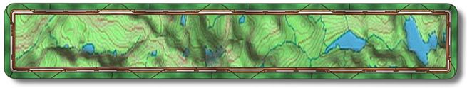
This trail is continuously crossing dirt roads, but it’s no problem to follow, just stay on the single track. On this trip we started at Stampede Reservoir and finished at the Donner Camp parking lot. So the profile is backwards from the "normal" route, there is more downhill this way, which is why we did it this way. This was the second time we had done the trail on the trip and it was the second trail we had done that day. The reason we did it twice is on another page of this site. Don't like to relive my mistakes so I won't be repeating it here. To do it as a one way with more downhill drive east from Truckee on Hwy 80 to Hirschdale Road. Go left at the end of the off ramp and continue past Boca Reservoir till you see the Stampede Reservoir dam on the left. The next paved road to the left will take you across that dam. If the road turns to dirt you missed the turn. Follow this road past all the campgrounds and boat launch until it makes a sweeping bend to left. After this bend if you go straight the road turns to dirt. Right after it becomes dirt there is a small dirt parking area on the right that has a large map of the Emigrant Trail. Don't make the right on the paved road just before the dirt. This is where we started our one way trip (N39.27.639 - W120.07.830). A tenth of mile after leaving the parking lot you will cross over a double track road, stay on the single track. You will cross over another at four tenths of a mile. At mile one you will cross over two roads. There will be another double track road at mile 3.4 and another at 3.5. At 3.9 you will cross a paved road, there is a sign indicating the single track on the other side of the road. The next crossing will be a motorcycle path at mile 4.6. A single track going from left to right will be at mile 4.8 but just stay on the single track you're on. You will cross over roads at mile 5.6, 5.8 and at 6.8 where at the last there is a Commemorative Trail and Prosser Campground sign. You should cross over a wooden bridge at mile 7.2 and wind up a hill. Yet another couple double tracks at mile 7.5 and 7.7 then a paved road that you will cross over, staying on the single track and following the Commemorative Trail sign. After flying down the single track where there are views of Prosser Reservoir and Creek off to your left you will come to a dirt road at mile 7.9 that you follow for fifty feet then drop down back onto the single track on your left. At mile 8.0 you come to the Prosser Creek Ford which isn't really recommended for bikes but I've taken it in late summer without getting too wet. This time of year (spring) it is out of the question so go straight on. Next you come to Hwy 89 at mile 8.5, walk your bike across the bridge against the traffic and then make a left u-turn at the end of the bridge railing to continue on the single track. On the hot days this is the coolest part of the trail as you ride through a very shaded and damp area. A mile later ride straight over the trail going right to left
at mile 9.5. At 9.9 stay to the right and look for the Commemorative Trail
sign. There is a paved road at 10.2 that you and I would naturally go straight
over but I had to collect the bro because he wanted to take it to the car
straight
away.
Cold Gatorade and beer was calling to him but that road does not take you
to your car so it is a bad idea. Another double track at 10.9 that you
will go straight over following the single track. At 11.4 miles you are
at the Donner Camp parking lot (N39.22.5363 - W120.10.8552). (NOTE:) Remember all mileages and GPS waypoints may not be
accurate as
my equipment may not be calibrated like yours so always be prepared
by talking with locals and/or picking up a map from one of the many local
bike shops before you venture out. |
Site created by D. J. Gabbard |