|
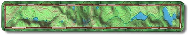
Western States Trail
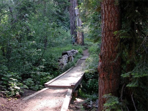
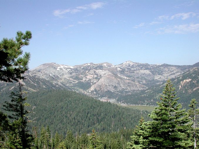
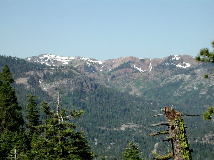
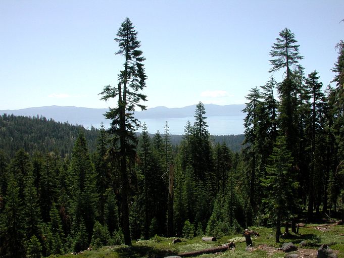
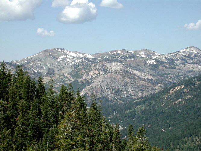
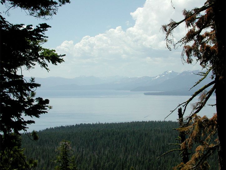
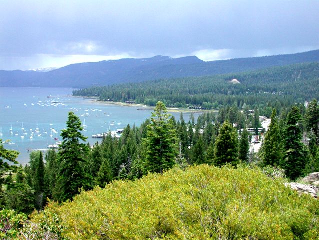
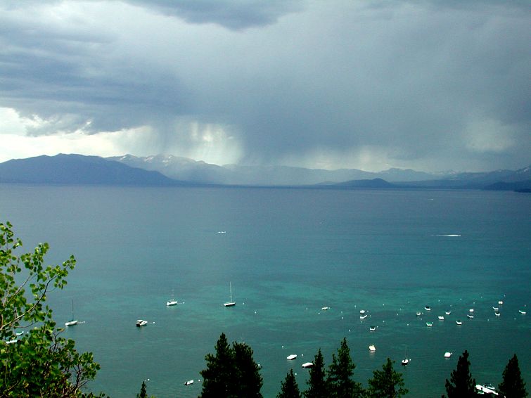
The Western States Trail or Mt. Watson Tour or whatever this collection of trails is called is a dandy. I've done it twice now and other than the first mile I haven't done it the same way, not even close to the same way either time. From here on out I'm going to call it "The Western States Trail" 'cuz that's what the sign said. Unfortunately these directions aren't the best I've done due to the way we wandered along the route. It was hard to be accurate with the mileage at each point because did a bit of backtracking. My advice is to print this, the trail map from the link above and get a local bike trail map when you go. Have more than one route so when you miss yours you have an alternate. On the bright side this one rivals The Flume when it comes to scenery and will always be on my list to do when I go to Tahoe. Someday I may figure out what the best route is. The way I've been doing it is to start off Hwy 89 and climb "The Wall". To get there from Truckee drive south towards Tahoe City on Hwy 89 until the river goes from on your left to on your right. Immediately after passing over the bridge you'll park on the right (N39.11.7641 - W120.11.8624). The bridge is a little over a half a mile south of the Squaw Valley Road. Ride north from where you parked down the steps made of railroad ties and turn right to go under the bridge on the dirt single track. Not the paved Truckee River Trail. After passing under the bridge (N39.11.7940 - W120.11.9004) you will begin the climbing, lots and lots of climbing. The good part about this route is you get the nasty climbing out of the way while you are fresh. You will leave the river at 6200' and top out at 7300' in 2 or so miles depending on the route you take to the top. One being up the road to The Wall and the other is The Missing Link. A little ways up the trail you will come to a wooden bridge over a small creek. I would have liked to get some more pictures here but the mosquitoes were hungry. At mile 1.4 is where we made our mistake and ended up on The Missing Link. My plan was to ride up the road to The Wall but it just didn't look right so we went right on the soon to be single track. The next time I do this trail I will make a left here following the road to The Wall and then if I come back this way I'll take The Missing Link back down opposed to riding down The Wall. The Missing Link would be a kick to ride down. If you do ride up The Missing Link you will make a left onto The Tahoe Rim Trail (TRT) at the top (N39.12.0163 - W120.10.8378). Soon you will come to the road that is the top of The Wall. Go across the road and continue on the TRT. If you rode up the wall the TRT will be on your left just after you top out. Going either way will get you a good look at Squaw Valley and Alpine Meadows. From here on out the mileages would be askew if you didn't take The Missing Link up so I'm not going to list them but I will list waypoints and list approximately how far between points. After crossing the road you will ride through some outstanding country. The first real viewpoint will be right after you have climbed a bit and the trail bends around to the left. At this point you will have a view of Lake Tahoe as well as a good look at where you are headed. A little ways down the trail when the trail bends to the right there will be a tiny loop to your left that is worth walking out to for another view of Squaw Valley. When you leave here the trail heads downhill till you get to the Fiberboard Freeway, which is a paved road (N39.12.8747 - W120.10.2017). This will be a sign indicating that Watson Lake is 5 miles ahead and Brockway 11 miles. Head straight on unless you need to get to town for some reason and if that's the case then make a right on the Fiberboard Freeway. Its paved 2/3rds of the way to Tahoe City then turns into a dirt. It should be mostly downhill though. But you don't want to go to town now so continue forward on the single track. Just down the trail will be another intersection, which will be a u-turn to the right (N39.12.8897 - W120.09.5376). As you ride along there will be multiple views of Lake Tahoe. Next, about 1.5 miles from the previous u-turn there will be a fork to the left that takes you to Watson Lake and beyond. That's for another trip though so we'll stay to the right here. Not far after the turn to go to Watson, maybe 2 tenths of a mile, there will be a single track going to the right (N39.12.7822 - W120.07.6348). If you get to a section where the bushes are scratching you on both sides then you've gone too far. This right heads down and gets steeper as you go. May be some places where you will want to walk your bike. There are no decisions to make until you get past the tuff stuff, less than a mile, then you will come to a T intersection (N39.12.4857 - W120.07.7570) where you will go right. 2 tenths of a mile down the trail (N39.12.3227 - W120.07.8813) another trail will enter from the right but stay on the one your on. In another 2 tenths you will come to a 4 way intersection (N39.12.1507 - W120.07.8121). Go right at this intersection to ride to Antone Meadows. You will ride through a meadow for just under a mile to another intersection (N39.12.1123 - W120.08.6076). What you want to do here is go straight even though it doesn't look like you would. You will see a raised single track just 100 feet ahead of you that you will go right on. A little over a mile down the trail you will come to a left hand bend that has a trail going off to the right (N39.12.2109 - W120.09.6201). If you want to go back to the top of The Wall and then down to your car make a right here and follow it up. I haven't done this yet so that's all I can tell you. We stayed on the trail and took the bend to the left. Antone Meadows and Burton State Park are on your left as you ride along. In another 1.2 miles you will come to a road that you will go right on (N39.11.8162 - W120.08.6306). 2 tenths of a mile down this road there will be a single track on the right that is best ignored. A little further down you will make a right on the next road (N39.11.5802 - W120.08.5417). Another half a mile or so down the road there will be a road coming in from the right, just ignore it and go left. Going down the road another 2 tenths or so you'll make a right onto the next road (N39.11.2302 - W120.08.1348). The dirt road ends in 3 tenths of a mile where you will come to Morning Glory Way (N39.11.0130 - W120.08.0248). This is a private area so I don't know how legal it is to be here so don't mess about. Go straight onto the pavement and follow it all the way down to N. Lake Blvd. About half way down there are views of Tahoe City, South Lake and to the east where the Flume Trail runs along the mountains above the Nevada shoreline. At N. Lake Blvd. make a right to Tahoe City. Cross the street where N. Lake Blvd. makes a left to go to South Lake then head up the left side of Hwy 89 to the Truckee River Trail and back to the car. Once back at the car you will have traveled more than 20 miles. (NOTE:) Remember all mileages and GPS waypoints may not be
accurate as my equipment may not be calibrated like yours so always be prepared
by talking with locals and/or picking up a map from one of the many local
bike shops before you venture out. |
Site created by D. J. Gabbard |