Tour de Granite

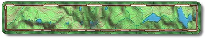
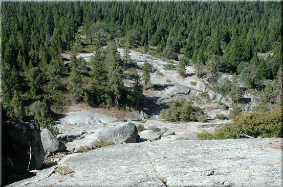
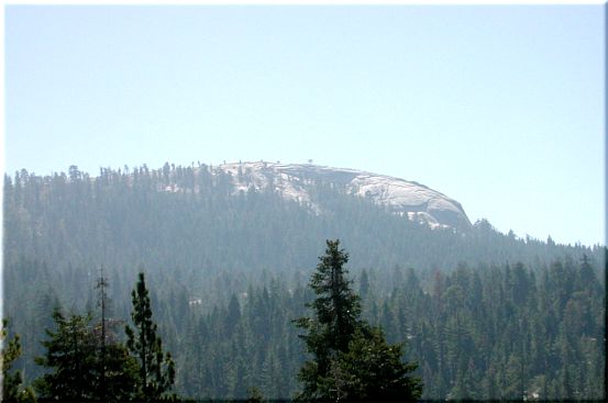
This ride is near Shaver Lake on the road to Dinkey Creek. 
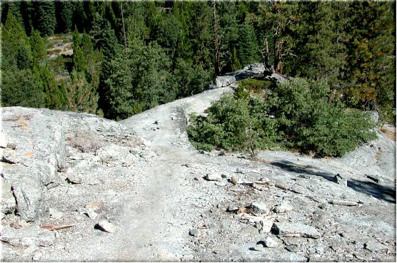
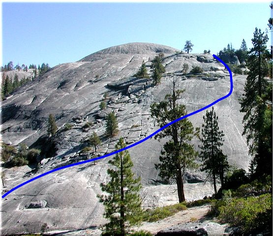
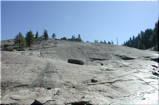
It's not an easy ride due to the granite portion of the ride. If you don't like walking up steep slabs of granite this will not be your cup of tea. Again I don't particularly like heights but this one is worth the effort. If you do this ride in mid to late August it is easy to follow because they hold a race up there in early August and the trail markers everywhere. Look for ribbons in the trees and chalk arrows on the granite. The ride is part loop, part out and back with a total distance of 7.8 miles.

Take Hwy 168 to Shaver Lake, just as you enter the town Shaver the road to Dinkey Creek/Courtright Reservoir/Wishon Reservoir will be on your right. Go right on Dinkey Creek Road for 6.4 miles or until you see forest service road 9S05 on your left. You can park just outside the gate (N37 05.6050 W119 14.1248) or drive up the road for a hundred yards and park on the right just past a sign with no text on the side you are approaching from. The single track starts just before this sign on the left side of the road. The start is just below 6000'.

About a half a mile out the single track you will come to a barbwire fence with a gate (N37 05.8335 W119 14.4496) down to your left. Go through the gate and head west. At mile 1.2 the single track becomes a double track/jeep road.

You will have been going gently downhill for awhile when you get to mile 2.0 (N37 06.3211 W119 14.3021). Make a left on the dirt road and head down with some speed across a bridge and up the next hill. For the most part you will be climbing for the next 2+ miles. There will be a Y at mile 2.6 (N37 06.7492 W119 14.4396), go right. In a short while this road becomes a single track and begins to climb rather radically. If you happen to go left it will end soon. Making a left might not be an option because they are logging in the area right now and the left appears to be a staging area.

The single track will top out on a slab of granite at mile 2.9 (N37 06.9333 W119 14.3688). You will head down the ridge of the granite to your left. On your right, across Stevenson Creek below is the granite face you will be climbing up. A guy I rode this with the first time road almost all the way up that face and I hear some others ride it. I'm not one of those people, walking up it works for me. Here is a shot from the creek bed, you'll be coming from the left just below those trees till you get to the center and then head straight up. The previous shot up the face from the creek makes it look a "little" steeper than it really is. This shot was taken from the top looking back down at the creek bed. A little further up is a nice place to take a break.

The highest point on the trail (6500') is at mile 3.9 (N37 07.1879 W119 13.7183). Southeast of here is Bald Mountain, the one with the lookout tower on top. The McNally fire's smoke is still coming up from Sequoia NF. From here you will ride down the rock and onto a single track for about a tenth of a mile. For the most part you will be going downhill for the next 1.8 miles.

Mile 4.0 (N37 07.2185 W119 13.6378) is where the single track stops at a double track/jeep road that you will go right on. You can get going pretty fast down this road so watch out for water bars as serious air can be obtained over these.

You will leave the double track at mile 4.7 (N37 06.9076 W119 13.8409) and head down the single track on your left. This single track will become a double track again in a half a mile or so. The double track will dump you onto the dirt road you came out on at mile 5.4 (N37 06.5455 W119 14.2403). Make a left onto the road.

After riding down the road across the bridge and up the little hill the road will go left and the double track you rode out on will be on your right. This is at mile 5.8 (N37 06.3215 W119 14.2989) and you can either take the road back to the car or turn right and go back via the double track/single track. I ride the single track back, either way you have some moderate climbing to do.

After a mile and a half you will come to the gate you passed through on the way out. It's at mile 7.3 (N37 05.8287 W119 14.4454) and it will be an easy ride back to the car. The car is at mile 7.8 (N37 05.6095 W119 14.1196) if you parked just outside the gate.

Site created by D. J. Gabbard
Copyright © 2000-2004
All rights reserved.