|
The Flume Trail
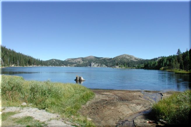
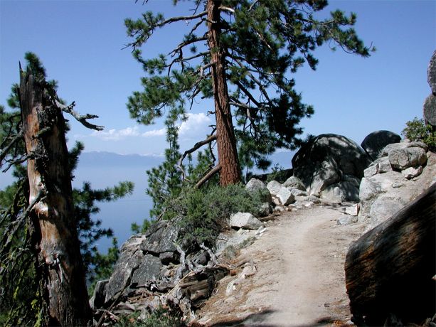
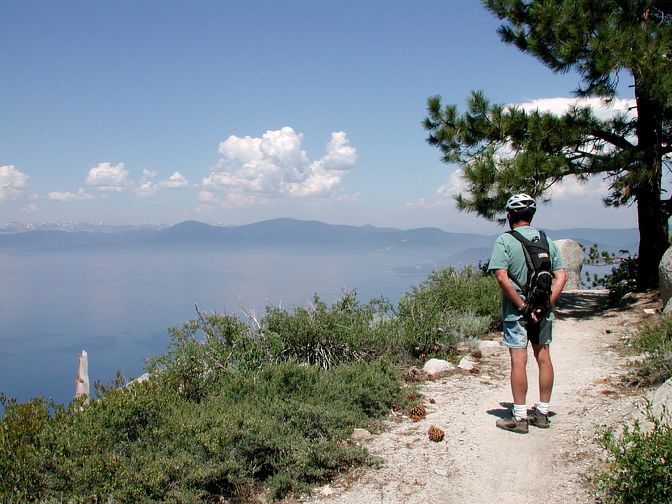
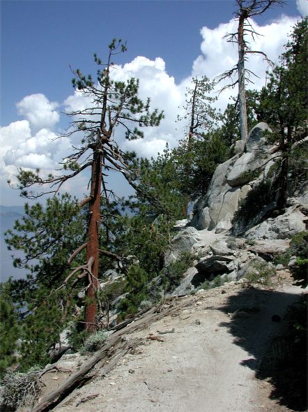
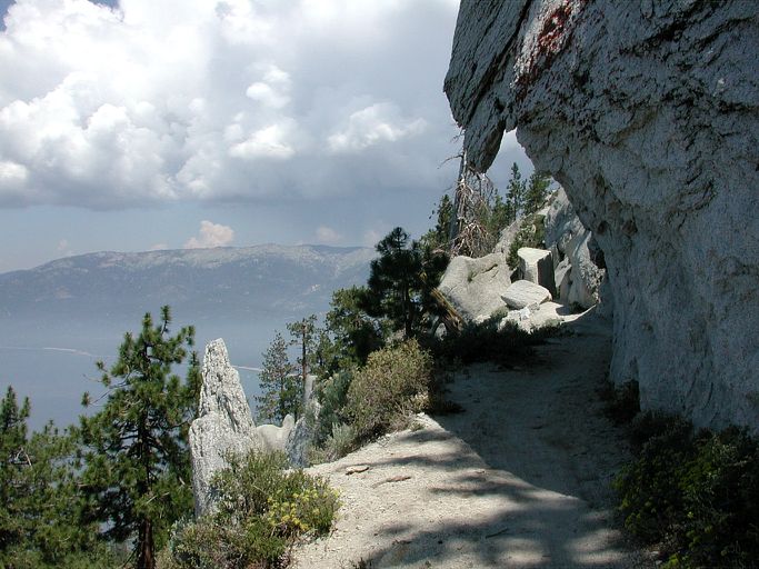
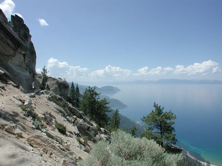
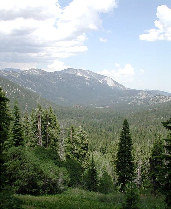
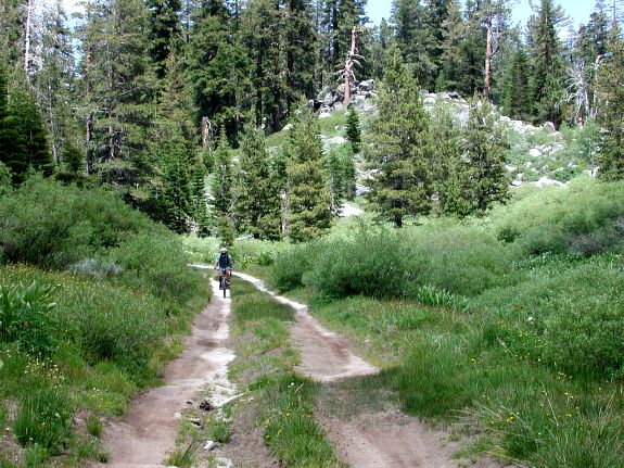
If you are traveling to Lake Tahoe to go mountain biking and this ride isn't on your list then you should have brought a real road bike. The Flume, as they say, is "The World Famous" mountain bike ride at Lake Tahoe. There are several routes here to fill the needs of a wide range of riders from the beginner/intermediate mountain biker to the mountain "goat" biker. The first 8-10 miles are the same for the two routes in the following description. The most popular way that beginner/intermediate riders like to do the ride is with a shuttle car. One car, the one with the bikes, riders and all the gear is parked at Spooner Lake Park. While the shuttle car, the one with cold Gatorade, beer, munchies and a change of clothes is at the Ponderosa. Doing it this way saves a lot of climbing! An option to this is you can take the free shuttle, which runs several times a day. If the free shuttle fits your needs just go park at Spooner Lake Park and start the ride. When you get to the Ponderosa the shuttle will leave at scheduled times to take you back. For me there is one major drawback to this...no Gatorade, beer, munchies and change of clothes. To do you own shuttle, park the shuttle car at the "Ponderosa" ranch. This is where the TV show was filmed. If you're coming from Incline Village on Hwy 28 it will be on your left, just look for all the old wagons and stuff in the parking lot. This is where you'll park the shuttle car or somewhere near here. If you're coming from South Lake Tahoe take Hwy 50 East and take a left on Hwy 28, which is just before Spooner summit and follow Hwy 28 to the Ponderosa on your right. Make note of Spooner Lake Park on your right soon after you turn left onto Hwy 28. After you drop off the shuttle car at the Ponderosa take the second car up to Spooner Lake Park. To get there drive south on Highway 28 away from Incline Village. Take a left at Spooner Park and park there. There is a fee to park at Spooner Lake Park of $5 dollars per vehicle. Bring plenty to drink and some energy food for the trail. After paying at the entry station, follow the road you're on as it bends to the left then park (N39.06.4155 - W119.54.9838) somewhere just ahead. Trail access is to the north of you and is easy to find. Enjoy the little downhill because there won't be much more for the next 4 miles. This road will top out (N39.09.3118 - W119.53.7536) a half a mile before and above Marlette Lake. Once over top it is a quick ride down to the lake. At the bottom there will be a 4 way intersection (N39.09.8720 - W119.53.7866), which is at mile 4.6. The lake is in front of you, a bathroom to the right and you'll make the hard left. This will take you over a small inlet creek with some info about trout breeding in the lake and then around the west side of the lake. No fishing is allowed in Marlette Lake. It is a nice easy 1.2 mile ride around the west side of the lake. At the end you may have to ride through a little lake water just before the dam, which is where The Flume Trail starts (N39.10.3601 - W119.54.4129). There should be a sign there but if not you will drop down onto the single track on the left side of the dam. After riding through a bit of technical stuff you will get your first views of Lake Tahoe. About a half a mile or so in I took a picture looking south and one of the trail ahead. Further down the trail you come to a right hand bend where you'll notice the trail is getting closer to the lake and the drop-off to the left is getting steeper. Around the right hander and down the trail you will have a view of Sand Point. As the trail winds along high above the lake there is another right hander that had Al wondering if the drop-off to the left was this steep two years ago. It has actually been improved as they have fixed a couple spots where you had to carry you bike across short stretches of jumbled rocks with a mind numbing drop just to your left. Al had forgotten this at the moment and to this day. One thing the both of us had noticed was normally when you look around while riding the bike tends to go where you look. That is not the case on this trail, the bike always goes hard right no matter where you look. Nothing better than a smart bike. A half a mile or so it's more of the same as the trail continues to weave its way through the rocks along the mountainside. Soon after that the trail passes under an overhanging rock where after riding through the rocky obstacle course I stopped to take a picture to the south. Our biggest concern was the thunderstorms that had been developing in the afternoons. When riding on the other side of the lake they were close by but never where we were riding. A few years ago I had gotten caught on the Flume by a very cold one and had to turn around and go back to the car. When we came around the next corner and I saw the clouds developing it had me a little worried that this trip may be cut a little short but this cloud bank never moved towards us. Although you don't want to carry any more than you need for this ride it can turn very cold quick up here. Even if if I had brought a wind jacket that day the storm came in I still would have gone back but the ride back would have been much more comfortable. So if you plan to take the long route check on the weather the day before and keep on eye on it during the ride. The Flume Trail is 4.4 miles from the Marlette dam to where you either make a left to head down Tunnel Creek Road to the Ponderosa. I can't give you much info on the route to the Ponderosa but I've heard that it is a short (2.5 mile) ride downhill. Or you can go to the right destined for the Red House, Twin Lakes or Tahoe Meadows. You could get lost going this way like we did a couple of years ago and have an epic adventure (see the Tahoe Trails page). Though, a couple of years ago there where no signs and I didn't have the GPS. This year there were signs at every intersection so if you have a map it's real hard to get lost. At this intersection (N39.13.1126 - W119.54.5756) you are 10.3 miles into the ride and if you choose to go to the Red House then 55% of the days climbing is still ahead. Both of us feel that even though the previous 4+ miles are some of the most scenic you'll find on a mountain bike trail there is much more to do and see to the right. So here we go. Head up the hill to the right for less than a half a mile. When you get to the top, there is a 4-way intersection with plenty of signage (N39.13.1576 - W119.54.2578). Going straight takes you to the Red House, left goes to Tahoe Meadows and 5 miles to the right is an unnamed campground. Spooner Lake is 14 miles from here. Straight we go, quickly down the hill to a fork at 10.9 miles (N39.13.0776 - W119.54.0755) into the ride where the right fork goes to Twin Lakes and the TRT (Tahoe Rim Trail) south. We plan to take this one next time up. But we go straight again down a long steep sandy hill. At the bottom of the sloppy sandy hill there is a dead end road to the left and our route is to the right. This turn is at 11.4 miles (N39.13.0728 - W119.53.6713). In two tenths of a mile you will stay right continuing on the single track. 1.5 miles down the trail look to the north where Franktown Creek runs through the center of Little Valley. At mile 13.6 (N39.12.3376 - W119.52.6296) you come to a fork where the Red House and Franktown Creek are to the left. Going right takes you to Hobart Reservoir and Marlette Lake. In a very short distance you will end up in nearly the same place. Two things that may influence your decision to go left here are the Red House and you don't care to shoulder your bike so you can walk over Franktown Creek on an old 2x8 ten feet above the creek. Two things that may influence you to go right are that you have already been to the Red House and you didn't go right the last time you were here so you didn't know you would end up in dam near the same place had you gone left. FYI, we went right for the last time. After either leaving the Red House or crossing the creek of death you ride up the road (N39.12.2523 - W119.52.3454) heading southeast. Just up the road at mile 14.3 of this route (N39.12.0329 - W119.52.1080) there is another fork. Having gone both ways now I can tell you that the one to the left leads to some views of Carson City and a very long day while the other leads to the hill from hell but a much shorter day. Going left you end up riding part of the TRT trail that is closed to bikes but that won't concern you much because you won't want to spend the night up there. The trail to the right takes you to Marlette Lake and if you look at the profile it's that last steep grade you see starting at mile 14.25 that climbs nearly a 1000' in 1.75 miles. It tops out at mile 16 (N39.11.1241 - W119.53.1765) a little over 8400'. This is where the trail from Twin Lakes and the unnamed campground comes in from the back right. The TRT goes left up here but it's closed to bikes and another goes right that we think is for access to the pump station at the end of Marlette Lake. A third of a mile ahead you will get a view of Marlette Lake with Lake Tahoe in the background (N39.10.8450 - W119.53.3216). From there you get to go downhill all the way to Marlette Lake at mile 17.6 (N39.09.8814 - W119.53.7871). Then it's a moderate climb back up the road that you came in on. Once you top out it's all downhill for the next 3.5+ miles back to the car. Save a little energy though, there is that little hill just before the parking lot at Spooner Lake Park. You don't want to be walking your bike up that one...someone might see you. (NOTE:) Remember all mileages and GPS waypoints may not be accurate as
my equipment may not be calibrated like yours so always be prepared by
talking with locals and/or picking up a map from one of the many local
bike shops before you venture out. |
Site created by D. J. Gabbard |